Wednesday, December 10, 2014
Monday, December 1, 2014
Watershed Assessment
I've been working on my watershed assessment for the New River and realized that I never showed where my sample points were located!
I used three testing locations across four weeks. The first was on Shorts Creek that feeds into the New River. The second is where Shorts Creek enters the New. The final location is 1 mile down the New River Trail at Foster Falls and is a large recreational zone.

I used three testing locations across four weeks. The first was on Shorts Creek that feeds into the New River. The second is where Shorts Creek enters the New. The final location is 1 mile down the New River Trail at Foster Falls and is a large recreational zone.

Monday, November 24, 2014
Tuesday, October 14, 2014
Success!
I have had a busy busy schedule at work that has tied up weekends and nights with meetings, so I haven't been able to update much. However, I just looked at my first set of water samples and we have success!!! Well, success if you consider finding tons of E.coli. I will post my protocol that I'm using a little later this week because I believe I would like to tweak the areas that I collect sampling.
One factor to consider while examining these colonies is that it had been raining for about a week. Rain leads to flushing of surrounding areas and typically creates an elevated count for bacterium.
but check out these....
One factor to consider while examining these colonies is that it had been raining for about a week. Rain leads to flushing of surrounding areas and typically creates an elevated count for bacterium.
but check out these....
 |
| I took four samples on 10/12/2014 at 3:30 pm. 2 are E.coli using Coliscan and 2 are just bacteria growth using Total Count |
 |
| Total Count of bacteria from the New River |
 |
| Total Count of bacteria coliforms from a tributary of the New River |
 |
| Purpe E.coli colonies from the Jackson Ferry area of the New River |
 |
| Check out ALL of those E.coli colonies!!! |
Monday, September 29, 2014
Invasive Plants
A widespread problem across this region is Multiflora Rose. It was originally brought to be a type of erosion control but then worked its way into every type of habitat imaginable! A lot of invasive species are originally introduced with good intentions, like kudzu.
Historical Impacts
In today's world, a lot of people focus on the current aspect of how our activities and events are influencing changes in watershed for the present and future. What we forget about is how actions in the past might still be altering the conditions of our environment.
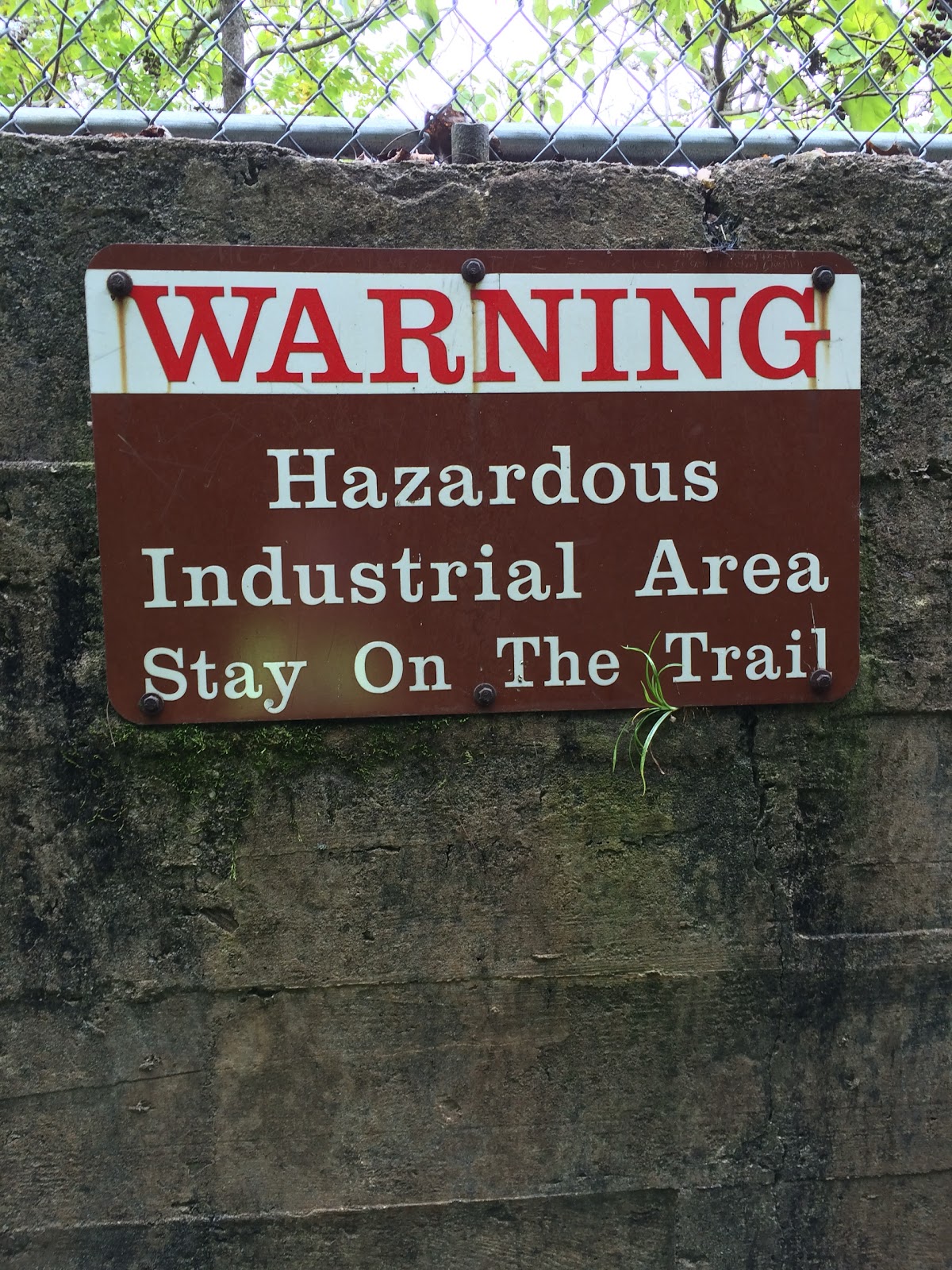
In 1981, lead and zinc mines were permanently closed along the New River in Wythe County. These mines had been in operation for 225 years and marked as the oldest continuously operating mines in the US. Rivers always led to industry being built around waterways for transportation and easy access to water for cooling of pumps and machinery. The historic mines around the Austinville area of Wythe County had frequent problems with water from the New River entering chambers and being pumped back into the river. After the closing of the mines that were then owned by New Jersey Zinc Company, the Dixon Lumber Company that owns the fields where mining waste was dumped for decades was ordered to remove the waste piles and restore the "affected waterways", meaning the New River and its' tributaries. However this 1999 deadline to restore the health of the waterways has be ultimately extended to June 1, 2015.
http://www.dmme.virginia.gov/commercedocs/VAMIN_VOL42_NO02.pdf
http://communities.washingtontimes.com/neighborhood/appalachian-chronicles/2013/aug/23/zinc-poisons-appalachias-new-river/
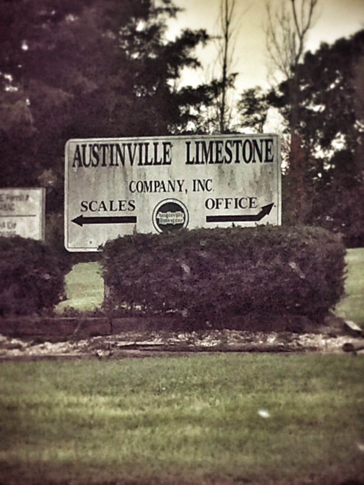 |
| Austinville Limestone is contracted with Dixon Lumber to be removing the mine waste from years of lead and zinc mines. |
 |
| One of the hazardous industrial fields that borders the New River Trail. |
 |
 |
| I tried to look over but I would need to grow another foot to be completely successful. This is one of the stockpiles of 'leftovers' from the zinc and lead mines. |
Sunday, September 28, 2014
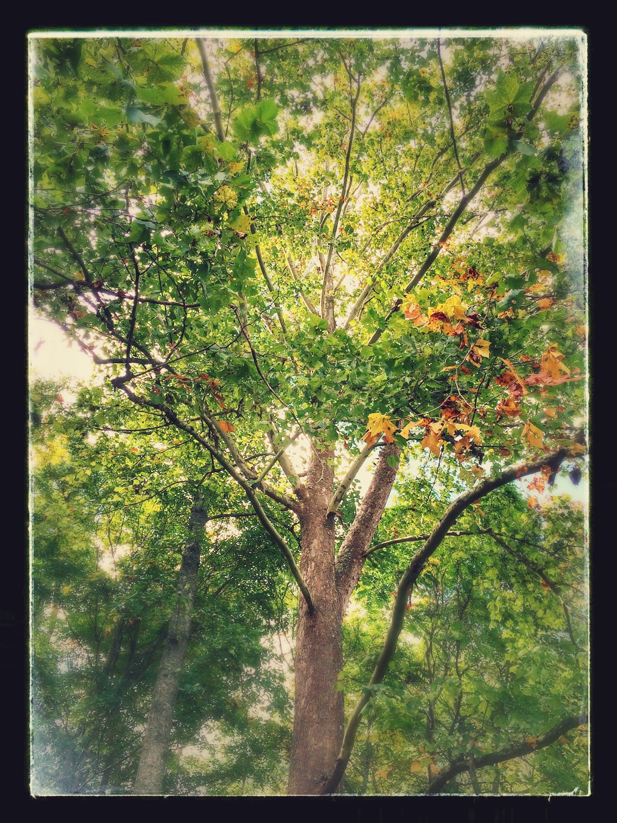
Local Trees
When you think about trees in general it is easy to rationalize that they're all the same. If you think about it all trees need sunlight, nutrients, water, and soil. However, trees are very much like humans in how you could classify them as having their own "personality." Some trees like American Sycamores and Silver Maples are more commonly found along water. Black Walnuts actually produce a type of toxin that makes it so plants do not grow around the base and compete for nutrients. Catalpas, Sweetgum, and Sycamores are considered "litter trees" due to the amount of debris they release to the ground.
Trees play an integral role in watersheds. They improve water quality, control flooding, and stabilize soil around embankments. One of the main problems with Virginia waterways is the percentage of embankments that have been degraded due to livestock use and erosion. When trees are removed to allow easy access to rivers and streams it provides a less stabilized bank and promotes erosion.
Trees play an integral role in watersheds. They improve water quality, control flooding, and stabilize soil around embankments. One of the main problems with Virginia waterways is the percentage of embankments that have been degraded due to livestock use and erosion. When trees are removed to allow easy access to rivers and streams it provides a less stabilized bank and promotes erosion.
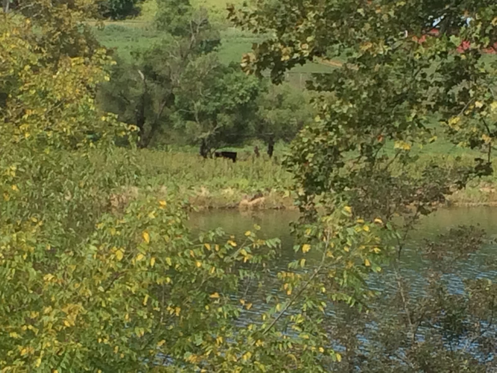 |
| Approximately one mile from a large recreational area cattle are allowed in the river. |
 |
| This is across from an area named the Shot Tower that made ammunition during the Civil War. |
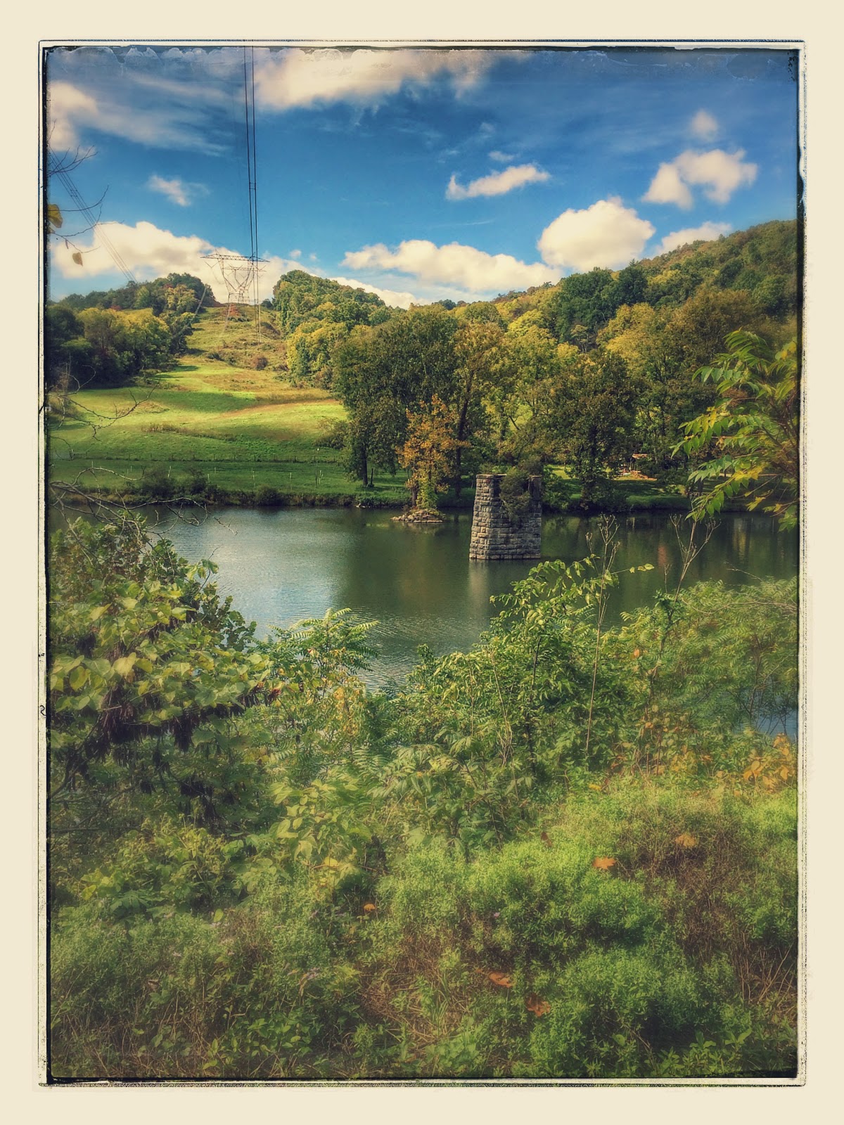 |
| Remnants from the old railway system and historical mines are still found in the river. |
 |
| If you travel the trail across the bridge you will go under an overpass of I 77. Wythe County is the only location where two major interstates (I 77 and 81) merge and there's not a major city. |
 |
| Fall is definitely in the air. The predominant trees immediately on the path are Black Cherry, Red Maple, White Oak, Northern Red Oak, Black Walnut, American Beech, and American Sycamore. |
 |
| This black walnut will be a good food for winter storage for a squirrel. |
 |
| This is an American Sycamore (notice the camo bark?) with a young Yellow Poplar (Tulip Poplar) to the left. Yellow Poplar trees make excellent trees for hunters to have their tree stands. They're tall and straight with white striations up the trunk. |
 |
| This is sassafras. Sassafras has been used in flavoring Root Beer. Notice the three different shapes of leaves? |
 |
| This is an American Beech tree. They have very smooth bark and after summers with rain and high nutrient absorption they produce a high mast that deer depend on in the fall. |
 |
| This is a Black Oak tree. If you dig a hole in its' trunk you will see a bright orange pulpy center. |
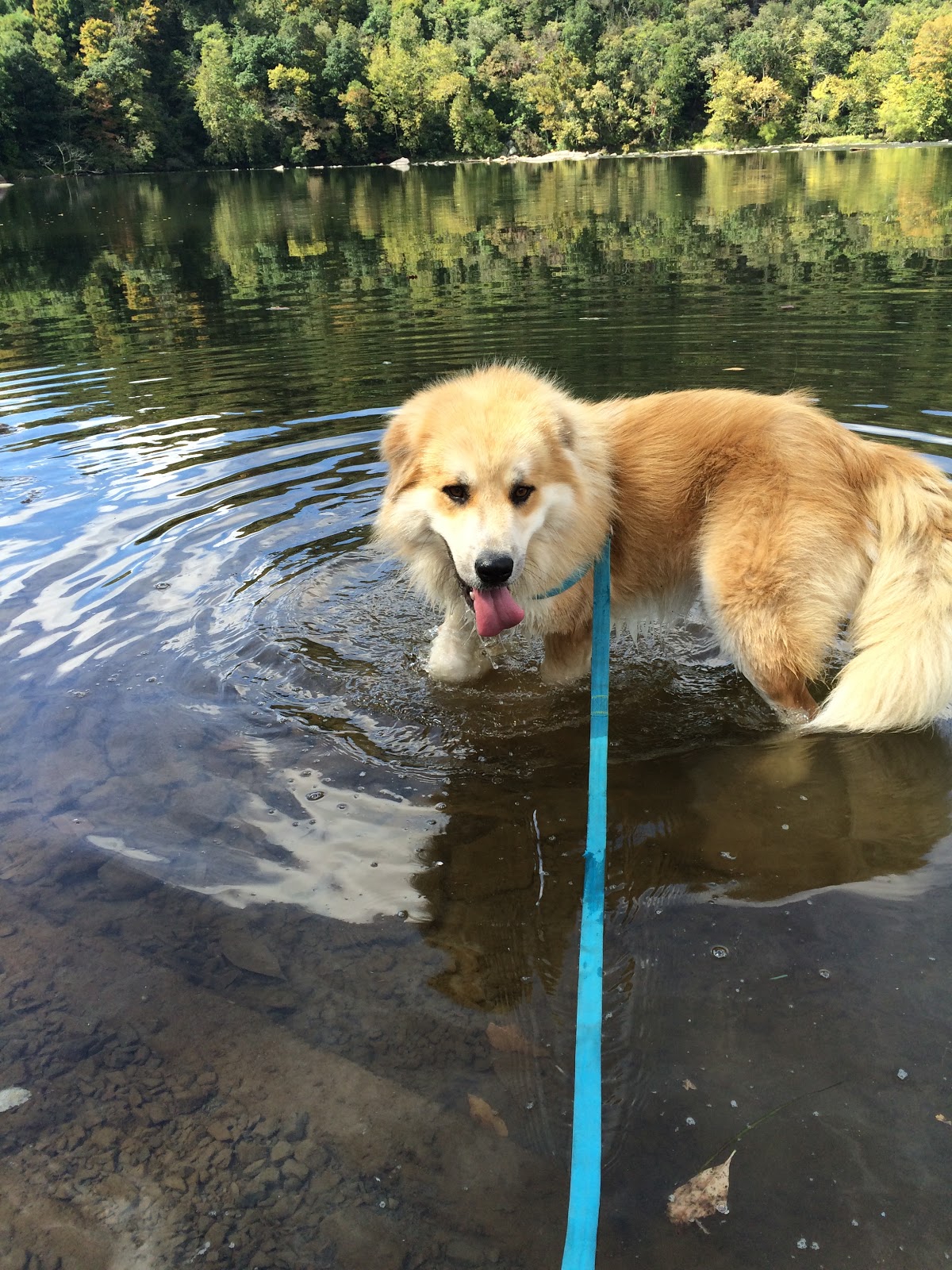 |
| Our dog, Redmond, enjoying the river at the recreational portion of the river. |
Sunday, September 21, 2014
New River Conservancy
The following Google Doc presentation covers information on the New River Conservancy that was previously known as the National Committee for the New River. If you would like to get involved in helping create healthier ecosystems in your current watersheds then check out your local watershed groups!
New River Conservancy
New River Conservancy
Monday, September 15, 2014
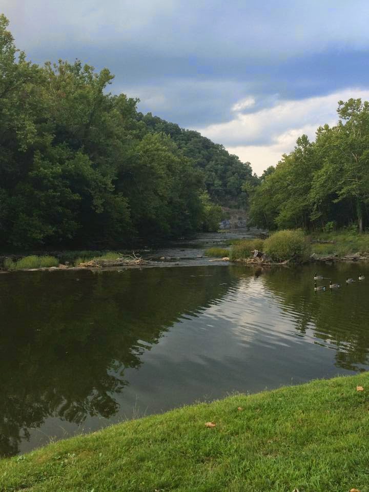
Along the New River Trail
 |
| Deer are frequently seen crossing this section of the river to the small landmass on the left hand side of the picture. This year I saw several fawns cross with their mom. Who knew deer were good swimmers? |
 |
| This section is known as Foster Falls. This area is a national historic district that now serves as the headquarters for the New River Trail State Park. |
 |
| Typically Canada geese are found surrounding this area. Campers tend to feed the animals that leads to a surplus of feces in the water along the embankment. |

The New is one of the few rivers that actually flows south to north.
 |
| The New River actually can be considered as one of the best fishing rivers in the state. |
The New River Trail is a converted railroad that is now a highlighted portion for joggers, horseback riders, and bicyclists that can take you to great areas for kayaking, swimming, and canoeing. What will be pictured later is the areas of the river and streams feeding into the river that have a greatly contrasted embankment and surrounding landscape.
This portion of the New is part of the Upper New Watershed. This watershed covers counties in North Carolina, Tennessee and of course Virginia.
Wednesday, September 10, 2014
Hello from Southwest, VA!
About 1 hour southwest from Virginia Tech you can find me, Kelsey, a graduate student in the Master of Natural Resources program and 4-H Extension Agent. I am a triple hokie; holding a Bachelor's of Science in Wildlife Science and a Masters of Agricultural Education. I am a large advocate for environmental education.
During the course of the fall semester I will be studying the New River. The New River is thought to be the second oldest river in the world, falling short in age only to the Nile. Many resources have reported that the New River was actually formed before the Appalachian Mountains rose across the eastern portion of the U.S. Who wouldn't want to study something as historic as the New?! The main issues that I am interested in is the level of E.coli levels in points across the county. Being from a large agricultural community that is dependent on the New for livestock it will be interesting to see the potential hazards that could be in place for the tourism economy.
During the course of the fall semester I will be studying the New River. The New River is thought to be the second oldest river in the world, falling short in age only to the Nile. Many resources have reported that the New River was actually formed before the Appalachian Mountains rose across the eastern portion of the U.S. Who wouldn't want to study something as historic as the New?! The main issues that I am interested in is the level of E.coli levels in points across the county. Being from a large agricultural community that is dependent on the New for livestock it will be interesting to see the potential hazards that could be in place for the tourism economy.
Subscribe to:
Posts (Atom)